Choosing the right partner for LiDAR mapping can make or break your project timeline, accuracy, and budget. The best way to choose a lidar drone scanning service canada provider is to focus on proven accuracy, airspace compliance, the right sensor-platform match, a transparent QC workflow, and deliverables that plug straight into your CAD, BIM, or GIS stack. In this guide, I’ll walk you through how procurement and project teams can evaluate vendors, what numbers to ask for, and how to avoid the common traps that cost time and money.
What to expect from a lidar drone scanning service canada
A high-quality lidar drone scanning service canada should deliver precise, clean, and ready-to-use data. Ask for:
- Point clouds in LAS/LAZ and optional E57, classified to ground, low/med/high vegetation, buildings, and utilities.
- Digital Terrain Model (DTM) and Digital Surface Model (DSM), with contours at 0.25–1.0 m or tighter where needed.
- Intensity rasters, breaklines, and hydro-flattening if you plan to generate topographic maps for design.
- Coordinate systems matched to your project (e.g., NAD83(CSRS) UTM Zones, and vertical in CGVD2013).
- A formal QA/QC report including check-point statistics, accuracy methodology, flight logs, and processing summary.
For many construction, mining, utility, and forestry sites, a top-tier lidar drone scanning service canada will target 3–5 cm vertical RMSE on hard surfaces when ground control and proper calibration are used. In vegetated terrain, expect ground accuracy to reflect canopy density and terrain slope; good providers will explain this upfront.
If you need broader capabilities beyond mapping—like thermal inspection or volumetrics—vet whether the provider offers integrated commercial drone services. Consolidating work reduces mobilizations and shortens schedules.
Accuracy and repeatability: specs that matter for a lidar drone scanning service canada
Accuracy is a process, not just a sensor spec. Judge providers on how they control and verify error, not on brochure numbers.
- GNSS/INS: RTK/PPK workflows and a high-grade IMU are non-negotiable for tight verticals.
- Calibration: Regular boresight calibration, with dated certificates, reduces strip misalignment and warping.
- Ground control and checks: Even with RTK/PPK, you need check points to validate results. Ask how many check points per hectare and how they are surveyed.
- Point density and scan pattern: Match density to outcomes. Utilities and detailed modeling can require 200–400 pts/m²; bulk earthworks often need less.
- QA/QC reporting: Insist on RMSE, mean bias, standard deviation, and per-surface checks (asphalt, concrete, exposed soil).
Before awarding, ask the lidar drone scanning service canada provider for a small test area or sample data. Review cross-sections at edges, curbs, and under light canopy. Look for clean ground classification and minimal striping.
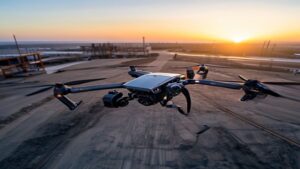
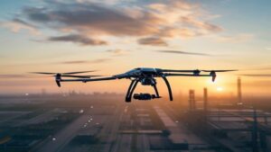
Hardware and workflow transparency from your lidar drone scanning service canada
Every step affects accuracy. A reliable vendor should outline flight altitude, speed, scan rates, overlap, and whether they use multiple headings to reduce shadowing. Expect a written plan, not guesswork.
Compliance and safety in Canadian airspace
Beyond data quality, safety and compliance protect your schedule and liability. In Canada, commercial operations require registered RPAS, certified pilots (Basic or Advanced), and appropriate airspace authorizations. For controlled airspace or operations near bystanders, Advanced certification and NAV Drone coordination are typically required. You can review national rules at Transport Canada’s drone safety page. Your vendor should handle SFOCs where needed, site surveys, and NOTAM reviews, and should carry appropriate aviation and general liability insurance.
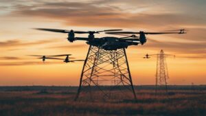
Sensor and platform choices: why they matter
A sensor-platform mismatch is a common cause of missed specs and rework. Ask which payloads and aircraft will be used, and why.
- Mid-range LiDAR (e.g., DJI Zenmuse L2): Efficient for corridors, aggregates, and general topography. Excellent cost-to-value, especially on Matrice platforms.
- High-end LiDAR (e.g., RIEGL miniVUX class): For dense canopy, tight modeling, and survey-grade verticals on complex terrain.
- Photogrammetry add-on: Multi-sensor missions (LiDAR + RGB) help with colorized point clouds and feature extraction.
- RTK base/PPK: Ask how base stations or virtual networks are managed and logged. Good logs make reprocessing possible if corrections improve later.
Properly configured, these systems can produce consistent, repeatable results. But success depends on the operator’s experience and the mission plan—not only the payload label.
Processing pipeline and deliverables you can trust
Top providers use mature software stacks and document their choices. Look for:
- Trajectory processing: Rigorous PPK with quality checks on satellite geometry and INS alignment.
- Point cloud refinement: Strip alignment, noise filtering, and ground-class algorithms tuned to your terrain.
- CAD/GIS handoff: LAS/LAZ, E57, DWG, SHP, GeoTIFF, and LandXML as needed, with consistent layer naming and metadata.
- Audit trail: Versioning, processing reports, and embedded CRS metadata for downstream teams.
Many teams process LiDAR with established platforms such as Pix4D and Trimble Geospatial tools. Your provider should explain how they handle classification, breaklines, contours, and QA so your engineering team receives usable files on day one.
How a lidar drone scanning service canada manages change
Design evolves. A strong process includes consistent file naming, revision logs, and delta comparisons between scans. This keeps survey data credible across weekly or monthly updates.
Pricing and scoping: what drives cost for LiDAR mapping
Transparent pricing protects your budget. Expect estimates that show:
- Mobilization: Travel, site inductions, safety orientation.
- Regulatory work: Airspace authorizations, SFOC if out of standard envelopes, and coordination time.
- Survey support: Ground control and check-point surveying with total station or GNSS rover.
- Flight time: Number of sorties, headings, and buffer passes.
- Processing: Trajectory, classification, QC, and deliverable packaging.
- Revisions: A set number of tweaks to layers or formats included in scope.
For reference, corridor scans and open-pit mines often price by kilometer or hectare, with economies of scale over larger footprints. Compared to conventional ground survey, a well-run lidar drone scanning service canada can reduce field days dramatically, capture dangerous or inaccessible areas, and deliver denser datasets that improve design and volume reporting.
When to use LiDAR vs. photogrammetry
LiDAR excels under vegetation, in low-texture surfaces, and for precise terrain under canopy. Photogrammetry is great for high-resolution textures, vertical facades, and when line-of-sight to the surface is clear. Many projects use both: LiDAR to get bare earth and accurate contours, RGB to colorize points and support feature extraction. A versatile provider will advise which tool—or combination—best matches your spec and budget.
Questions to ask a provider of lidar drone scanning service canada
- What vertical and horizontal accuracy can you commit to, and how will you prove it with independent check points?
- Which LiDAR, aircraft, and GNSS/INS will you use, and why are they right for our terrain and canopy?
- How many passes, headings, and point density will you plan for? Please include scan rate and flight altitude.
- What is your boresight calibration process and frequency? Can we see certificates or recent calibration logs?
- Can you share an anonymized QA/QC report from a similar project, including RMSE and bias?
- How will you deliver data (CRS, file types, layers)? How do you manage revisions and version control?
- Do you carry aviation and general liability insurance, and are your pilots certified for Advanced operations where needed?
- What’s the contingency plan for weather, GNSS outages, or airspace holds?
If a vendor can’t answer these clearly, keep looking. Mostavio-SkyTech documents everything from pre-flight plans to final check-point statistics and will align deliverables to your engineering standards.
Operational readiness and safety culture
LiDAR flights can involve low altitudes, multiple headings, and long corridors. That increases complexity. Seek a team with a formal SMS, JHAs, daily briefs, and documented emergency procedures. Verify they can coordinate with site supervisors, rail/road closures where required, and local stakeholders. This reduces stoppages and protects your schedule.
Scalability: lidar drone scanning service canada across multiple sites
National programs need standardized methods. Your provider should scale crews, maintain consistent calibration, and use shared templates for processing and deliverables. This enables like-for-like comparisons across regions and time.
Why Mostavio-SkyTech is a strong choice
Based in Toronto and serving projects across Canada, Mostavio-SkyTech brings together experienced RPAS pilots, survey technologists, and data engineers. We operate enterprise-class LiDAR payloads on reliable aircraft, with RTK/PPK workflows and rigorous QC. Our team is Transport Canada certified for Advanced operations and experienced in controlled airspace authorization and complex sites.
- Accuracy-first: We publish RMSE and bias by surface type and provide check-point spreadsheets with photos and methods.
- End-to-end data: We deliver LAS/LAZ, E57, DTM/DSM, contours, breaklines, and CAD/GIS files aligned to NAD83(CSRS) and CGVD2013.
- Integration: Our workflows connect directly with your BIM/CAD environment, and our aerial data and analytics team can build dashboards, quantity reports, and change detection.
- Safety and compliance: Documented SMS, job hazard analyses, and full insurance for peace of mind.
- Scalable teams: We handle one-off sites or national programs with standardized methods and reporting.
If your scope expands beyond mapping, our engineering group builds custom payload integrations and automation. And our operations team can fold LiDAR capture into larger inspection or construction workflows, reducing mobilizations and cost.
How we de-risk your LiDAR project
We begin with a clear technical plan: required accuracies, pass geometry, density targets, and QA criteria. Before flight, we align on coordinate systems and file formats with your survey and CAD leads. During operations, we monitor GNSS quality and weather, and adjust plans to protect deliverables. After processing, you receive a full QA/QC package and sample sections for rapid review. If any area needs more density or a second heading, we can re-fly fast.
A proven lidar drone scanning service canada workflow
Our step-by-step approach—planning, controlled capture, disciplined processing, and transparent QA—keeps projects on schedule and data rock solid. This repeatable process is what you should expect from any lidar drone scanning service canada provider.
Summary: choosing the best partner for LiDAR
The right lidar drone scanning service canada delivers measurable accuracy, compliant operations, and data that drops into your workflows without friction. Insist on clarity around GNSS/INS methods, calibration, ground control, point density, and QA/QC. Review sample datasets and reports before award. Ensure safety, insurance, and airspace authorizations are in place. Finally, choose a partner who can scale and support the broader data lifecycle, not just fly a sensor.
Mostavio-SkyTech provides a turnkey lidar drone scanning service canada with survey-grade deliverables, national reach, and a safety-first culture. If you’re scoping a corridor, mine, forestry block, utility span, or construction site, we can help you plan the right approach, price it transparently, and deliver on schedule. Let’s discuss your site constraints, accuracy targets, and deadlines, and we’ll tailor a plan that meets your objectives. You can also book a free consultation to review sample data and QA reports.
Ready to Take the Next Step?
Whether you need drone pilot certification, a custom engineered
solution, help navigating Transport Canada permits, or a professional
drone service for your next project — Mostavio-SkyTech is your
trusted partner in Canada.
Contact us today for a free consultation
and let’s build something great together.