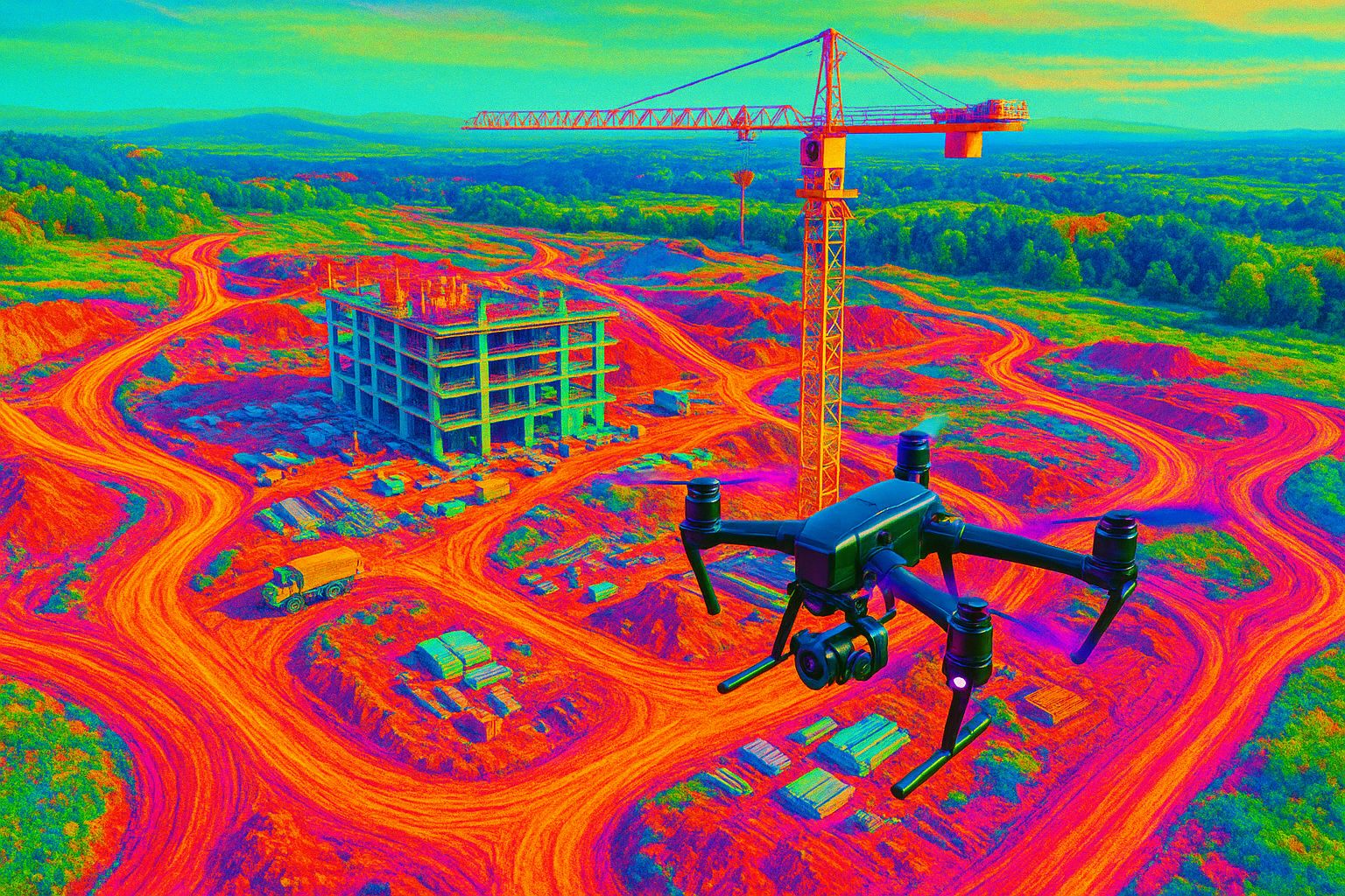
General contractors and owners use drones to see and measure their sites every week — without stopping work or waiting on survey crews. A construction site progress monitoring drone delivers current orthomosaics, 3D models, volumes, and production reports within 24–48 hours, so you can validate pay quantities, track schedules, and resolve disputes fast. Mostavio-SkyTech operates nationwide in Canada, providing repeatable flight plans, RTK precision, and standardized deliverables your team can trust.
How a construction site progress monitoring drone program works
The goal is simple: collect consistent aerial data on a fixed cadence and turn it into metrics you can act on. As a turnkey provider, we design your capture plan, fly safely under Transport Canada rules, and deliver measurable outputs into your existing tools. We bundle this as part of our commercial drone services so procurement is straightforward and outcomes are guaranteed.
- Discovery and scoping: We align to your site plan, design surfaces, and reporting needs (earthworks, utilities, structures, safety documentation).
- Flight plan and controls: Pre-defined corridors and grids at set altitudes, 75–85% overlap, RTK/PPK workflows, and ground control where required.
- On-site operations: A Transport Canada-certified pilot arrives with the right platform and backup aircraft, coordinates with your superintendent, and executes the mission with minimal disruption.
- Processing and QA: Imagery and LiDAR (if tasked) are processed using industry-leading photogrammetry, then validated against checkpoints before release.
- Delivery and review: Web maps, 3D models, PDFs, and CSVs land in your inbox and cloud drive. We host interactive viewers for easy sharing with stakeholders.
That’s the framework of a construction site progress monitoring drone program — consistent capture, predictable outputs, and measurable accuracy week after week.
Selecting the right construction site progress monitoring drone for each site
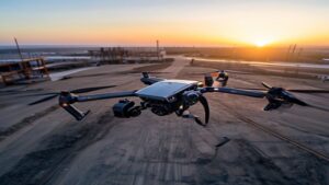
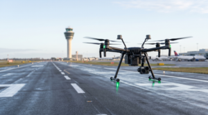
Different jobs need different aircraft. For frequent progress captures of mid-size sites, we often deploy DJI RTK photogrammetry platforms for efficiency and precision. For larger earthworks or dense structures, we scale up to heavy-lift aircraft and specialized payloads.
- Photogrammetry (RTK): Ideal for weekly orthomosaics, cut/fill, and stockpile volumes. With a well-surveyed site and checkpoints, horizontal accuracy of 2–3 cm and vertical accuracy of 3–5 cm is typical.
- LiDAR: Best when vegetation or rebar cages obscure the ground. Delivers high-confidence surfaces, even in low-light windows, with robust classification.
- Thermal/zoom: Useful for building envelope checks, façade conditions, and safety observations (e.g., open trenches, hot spots).
We make the “platform vs. payload” decision for you, based on the reporting accuracy you need and the schedule you’re holding. In every case, the construction site progress monitoring drone must be safe, compliant, and precise.
Scheduling your construction site progress monitoring drone flights
Cadence drives value. Weekly is the most common, but some owners request bi-weekly during peak earthworks or concrete cycles. We lock in your windows to avoid crane picks and concrete pours, coordinate NAV CANADA authorizations when needed, and keep a weather fallback calendar. Your construction site progress monitoring drone flights are always confirmed 24 hours prior with a go/no-go update at H-2 hours.
Deliverables and accuracy from your construction site progress monitoring drone
Consistency and accuracy are the core of a strong program. Our QA process includes RTK logging, checkpoint residuals, and visual inspections before you receive files. Typical deliverables include:
- Orthomosaic (GeoTIFF + web map): High-resolution, measurable imagery of the entire site for plan overlays and markups.
- Digital Surface Model (DSM) / Digital Terrain Model (DTM): Elevation surfaces for cut/fill metrics and drainage checks.
- Point cloud and 3D mesh: For clash detection, as-built verification, and stakeholder walkthroughs.
- Volumetric and earthworks reports: Stockpile quantification, haul tracking, and weekly progress deltas.
- Progress photos and videos: Milestone documentation, stakeholder updates, and safety briefs.
- Change detection and progress indices: Automated comparisons week-over-week to flag out-of-tolerance areas.
We process photogrammetry with trusted software used worldwide in survey and construction workflows. Platforms like Pix4D and Trimble geospatial solutions support robust analytics, GCP workflows, and open exports, so your teams can integrate results into BIM, GIS, and estimating systems. With proper controls, a construction site progress monitoring drone can deliver 2–3 cm planimetric accuracy and 3–5 cm vertical accuracy for survey-grade mapping tasks. For volumetrics, many sites see ±1–3% error versus ground surveys, assuming suitable surface conditions and checkpoints.
Where a construction site progress monitoring drone creates the most ROI
Time and safety are the first wins, but the hidden ROI is better decisions. Here are common use cases where the numbers add up fast:
- Earthworks tracking: Replace weekly ground topo walks. One 30-minute flight can cover 25–50 hectares, saving 6–10 crew hours per week.
- Quantity verification and pay apps: Tie volumes and installed work to dates with tamper-proof imagery, reducing billing disputes and rework.
- Schedule coordination: Share web maps and 3D with trades so everyone sees lane closures, laydown areas, and crane swing zones.
- Safety and documentation: Capture conditions before/after critical activities to support claims, due diligence, and incident reviews.
- Owner transparency: Give stakeholders crystal-clear, current visuals without escorting large groups on site.
Compared to manual methods, clients typically cut progress measurement costs by 30–60% while improving frequency and quality. A construction site progress monitoring drone doesn’t just replace a task — it upgrades the entire decision cycle.
Safety, compliance, and privacy on Canadian job sites
Every flight is planned to meet Transport Canada rules for the operation class and airspace. We manage NAV CANADA authorizations where required, coordinate with your site supervisors, and brief crews before takeoff. We set defined geofences, maintain visual observers when needed, and operate with a conservative weather envelope. Data security and privacy matter — we control data paths, encrypt storage, and limit distribution to named stakeholders. Your construction site progress monitoring drone program is safe, compliant, and respectful of neighbours and workers.
Workflow integration: BIM, PM, and survey ecosystems
Deliverables from your construction site progress monitoring drone drop straight into tools you already use. We support:
- BIM and coordination: IFC, Revit, and Navisworks overlays for as-built vs. design checks.
- Project management: Links and embeds for Procore, Autodesk Construction Cloud, and similar platforms.
- Survey/CAD: DXF, LandXML, and LAS/LAZ for civil design teams and quantity surveyors.
- Reporting: PDF rollups, CSV cut/fill tables, and hosted viewers for fast sharing.
If your team wants to bring some capabilities in-house, we can help design the hybrid model and recommend hardware, software, and SOPs — and we’re happy to backstop your team during peak load or complex flights.
Our process and coverage across Canada
Mostavio-SkyTech is Toronto-based, with national reach for multi-site builders and owners. We standardize your construction site progress monitoring drone deployments across projects so every site reports the same way. Our method:
- Standard operating procedures: Repeatable flight plans and QA for consistent results.
- Scalable resourcing: Multiple RTK platforms and certified pilots to cover tight windows and large campuses.
- Rapid turnaround: Same-day previews and 24–48 hour full deliverables, with rush options available.
- Transparent pricing: Per-flight, per-hectare, or subscription models that fit GC and owner-operator budgets.
To see how this would fit your specific project, you can book a free consultation with our operations team. We’ll map scope to outcomes and provide a clear statement of work and timeline.
What to expect on day one: your first construction site progress monitoring drone capture
Before the first flight, we align on geofences, emergency procedures, and staging areas. We verify your control network if provided. The pilot checks in with the superintendent, confirms airspace status, and conducts a safety brief. We launch, collect the mission in one or two sorties, and clear the area. You receive a quick-look map the same day and complete deliverables within 24–48 hours. After week two, we start delivering delta analytics — the real power of a construction site progress monitoring drone program.
Procurement checklist for your construction site progress monitoring drone partner
- Accuracy commitment: Clear targets (e.g., 3–5 cm vertical) and evidence of checkpoint QA.
- Compliance: Transport Canada-certified pilots, proper insurance, and NAV CANADA coordination process.
- Data security: Encrypted storage, controlled access, Canada-hosted options if required.
- Scalability: Ability to cover multiple sites and surge hours.
- Interoperability: Open formats and integrations with your BIM/PM stack.
Mostavio-SkyTech meets each of these standards and can tailor SLAs to your risk profile and schedule.
Construction specialties we support
- Heavy civil: Highways, bridges, rail, and mass earthworks — frequent volumes and alignment checks.
- Commercial/industrial: Warehouses, plants, and retail — slab flatness insights and steel progress validation.
- Residential and mixed-use: Phasing, stockpiles, and amenities tracking for owners and lenders.
- Public infrastructure: Water, wastewater, and utilities — as-built documentation and corridor mapping.
For deeper industry detail, explore our drone services for construction overview to see sample outputs and integration paths.
Why clients choose Mostavio-SkyTech for their construction site progress monitoring drone program
- Accuracy by design: RTK/PPK workflows, control validation, and peer-reviewed processing steps.
- Operational maturity: A safety-first culture, standardized SOPs, and Transport Canada-compliant practices.
- Open data and support: You own your data. We help your teams adopt it quickly and effectively.
- Proven platforms: Enterprise-grade aircraft and sensors with redundancy and documented maintenance logs.
We also advise owners who want to blend outsourced flights with selective in-house capture. If you’re evaluating your own fleet, see our product line of enterprise platforms; we can align hardware and SOPs so your site team and our crew operate as one. For broader context on industry-grade gear, review DJI’s enterprise lineup at dji.com/enterprise alongside software options from Pix4D.
Conclusion: Put a construction site progress monitoring drone to work this season
Weekly, measurable site intelligence beats guesswork every time. A construction site progress monitoring drone gives you current maps, quantified volumes, and a verifiable record of work — all delivered fast and safely, across Canada. Whether you’re a GC, owner, or consultant, the data improves coordination, reduces risk, and accelerates decisions. If you are exploring a pilot on a flagship project or want to standardize across your portfolio, Mostavio-SkyTech can deploy within days and keep you on schedule. Learn more about our end-to-end approach in our drone solutions, or reach out to scope your first site.
Ready to Take the Next Step?
Whether you need drone pilot certification, a custom engineered
solution, help navigating Transport Canada permits, or a professional
drone service for your next project — Mostavio-SkyTech is your
trusted partner in Canada.
Contact us today for a free consultation
and let’s build something great together.