Oil and gas operations demand sensors, software, and airframes that work together flawlessly in harsh conditions. If your challenge is detecting methane leaks in sub-zero winds, inspecting a flare stack during a short turnaround, or pushing real-time video and gas concentration data into your enterprise systems, you need more than an off‑the‑shelf drone. You need custom uav integration for oil and gas canada—engineered to your standards, validated to your safety protocols, and supported by a Canadian team that understands the field realities from Fort McMurray to Kitimat.
Why custom uav integration for oil and gas Canada is different
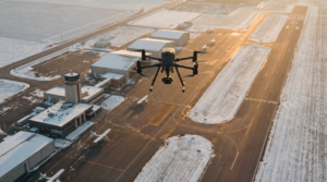
Canada’s energy sector presents unique constraints that shape integration choices. Cold-weather performance, electromagnetic interference around industrial equipment, controlled site access, and remote logistics all add up to a demanding environment where a generic payload won’t cut it. Custom uav integration for oil and gas canada means designing the entire stack—payload, power, comms, software, and workflow—so your crews capture the right data on the first flight and your stakeholders can act on it immediately.
From our Toronto facility, Mostavio-SkyTech designs and delivers integrated UAV systems that meet oil and gas realities across the country. We merge field-tested hardware with robust software, and we validate integrations in climate-aware test protocols so your platform is mission-ready the moment it arrives on site. If you need immediate capacity while your custom system is built, our operational teams can also execute turnkey inspections through our commercial drone services practice—ensuring zero downtime for critical projects.
Use cases that require more than off‑the‑shelf
- LDAR and methane quantification: Integrate laser-based methane sensors or multi-gas analyzers with precise geotagging and wind data to localize and estimate emissions.
- OGI and thermal correlation: Stabilize cooled mid-wave OGI payloads and pair radiometric thermal for cross-validation of fugitive leaks, hot-spots on flare lines, or insulation failures.
- Flare stack and elevated asset inspection: Build UV/visible/thermal tri-sensor payloads with high-temperature proximity envelopes and live annotations for maintenance teams.
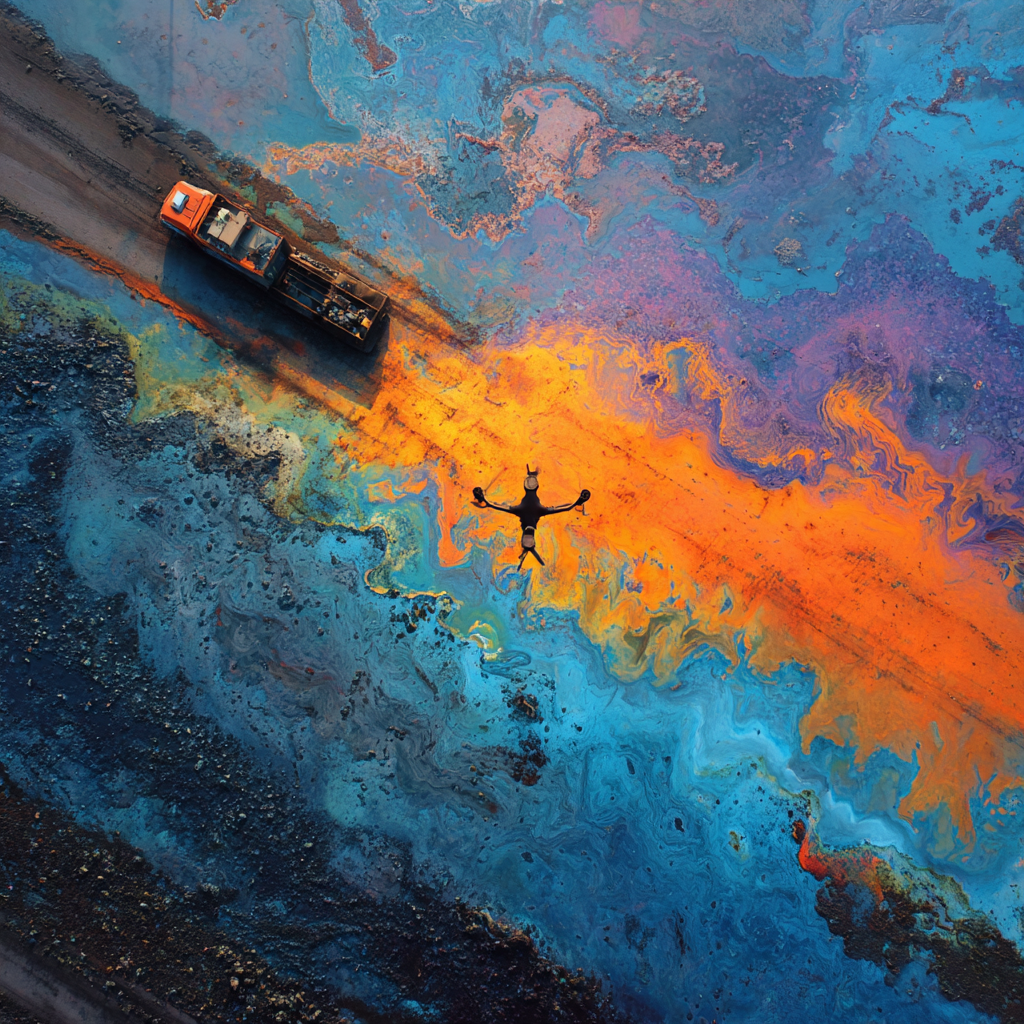
- Pipeline right-of-way monitoring: Fuse high-resolution RGB with multispectral or hyperspectral sensors for vegetation stress and hydrocarbon sheen detection; stream alerts to GIS.
- Emergency response: Deploy rapid-mount payload kits with shared UI profiles so crews can swap sensors (gas, thermal, zoom) within minutes during spill or fire incidents.
Our engineering approach to custom uav integration for oil and gas Canada
We treat custom uav integration for oil and gas Canada as a disciplined engineering program with defined gates, documentation, and service-level guarantees. You get a single accountable partner—from concept to fleet deployment—without handoffs between unrelated vendors.
1) Discovery and specification
- Operational goals: What decisions will this data drive? Leak repair prioritization? Permit closeouts? Emissions inventory?
- Constraints: Flight envelopes, site access control, hazardous location requirements (e.g., Class I, Div 2 areas), data governance rules.
- Integration targets: CMMS/EAM (SAP, IBM Maximo), emissions reporting tools, or custom dashboards.
2) Platform and payload architecture
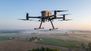
Most clients standardize on a rugged RTK multirotor such as the DJI Matrice 350 RTK for its mature Payload SDK, SkyPort/E-Port interfaces, IP55 rating, and fleet maintainability. Where lift or flight-time demands exceed this envelope, we offer heavy-lift options and fixed-wing VTOLs for long linear assets. On DJI platforms, we leverage the PSDK for payload power and controls, and the OSDK for onboard compute where edge AI is required.
On the Matrice 350 RTK, for example, you can expect up to 55 minutes of flight time (no payload) and up to 2.7 kg maximum payload capacity, with RTK-enabled positioning and robust GNSS redundancy—capabilities detailed on DJI’s enterprise spec pages (DJI Matrice 350 RTK). We translate those lab specs into field reality by modeling your payload mass, drag, and temperature effects to predict practical flight durations and safety margins.
3) Electrical and mechanical design
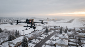
- Power budget and conditioning: We dimension power draw under peak loads, add filtering for noise-sensitive sensors (e.g., TDLAS), and design thermal paths for -30°C to +40°C operation profiles common in Canada.
- EMI mitigation: Shielded harnesses, grounding strategies, and layout to protect high-impedance sensor lines near motors and radios.
- Mounts and gimbals: Custom adapters for vibration isolation, balance, and payload CG alignment; IP-aware enclosures for precipitation and dust.
4) Software, UI, and data handling
- PSDK applets in DJI Pilot 2: Custom UI panels for sensor control, calibration steps, and QA prompts—reducing pilot workload and standardizing procedures.
- Time sync and geotagging: PTP/NTP alignment, one‑pulse‑per‑second where supported, and metadata fusion so every pixel/ppm is tied to precise coordinates and altitude.
- Live streaming and APIs: RTSP/SRT video, MQTT/REST for sensor data uplinks, and encryption in transit. Edge inference can triage detections before they hit your network.
5) Environmental and safety validation
We test thermal soak, cold-start, vibration, and drop safety, then conduct structured flight trials. For operations near hazardous areas, we design to your safety case and can coordinate with third-party labs for conformity assessments aimed at Class I, Div 2 usage where feasible. All results feed a documentation pack your HSE and engineering teams can review and approve.
6) Training, deployment, and support
We onboard your pilots and technicians with role-based training, spares kits, and maintenance schedules. A dedicated integration lead supports your first missions, and our remote diagnostics help your team get answers quickly—so your custom system performs reliably year-round.
Example payloads enabled by custom uav integration for oil and gas canada
The right integration transforms a drone into a verifiable measurement instrument. Below are representative payload categories we commonly integrate for Canadian oil and gas operations.
Methane and multi-gas quantification
Laser-based methane sensors and multi-gas analyzers require careful airflow management, vibration control, and synchronized wind measurements to estimate emission rates. We implement intake geometries, flow characterization, and timestamp alignment so your reports include leak localization, estimated mass flow, and confidence intervals—supporting LDAR programs and emissions inventories aligned to evolving ESG standards. Industry groups continue to document best practices for UAV emissions monitoring, reflecting rapid adoption across energy operations.
Optical Gas Imaging (OGI) with corroborated thermal
For fugitive emissions detection, stabilized cooled MWIR cameras paired with radiometric thermal imaging and zoom RGB produce corroborated visuals. Our integrations streamline operator workflow: one-touch record for synchronized OGI and thermal, automated geotagging and plume annotation, and an on-screen checklist to document environmental conditions—critical for defensible LDAR findings. This is a core target for custom uav integration for oil and gas Canada because it reduces repeat site visits and speeds repairs.
Flare stack and elevated equipment inspection
We integrate high-resolution optical zoom, UV (for corona or flame-tip behavior insight), and thermal sensors on a single gimbal where weight permits. Real-time overlays show temperature bands and structural markers. For high-temperature environments, we add thermal shielding and standoff extensions to maintain sensor health while achieving inspection angles that ground crews or helicopters struggle to reach safely.
Right-of-way and facility mapping
When linear infrastructure or large plants require periodic mapping, we combine RTK imagery with AI-based change detection to flag encroachments, erosion, or stressed vegetation potentially indicating a subsurface issue. Data products can be piped to your GIS or asset management systems, and our team can deliver automated web dashboards for non-technical stakeholders.
Data, compliance, and operations at scale with custom uav integration for oil and gas Canada
Integration isn’t just hardware. Your success depends on getting decision-ready data to the right team members while meeting corporate security and Canadian regulatory expectations. We architect dataflows with role-based access, retention policies, and encryption at rest and in transit. Where your operations involve controlled airspace, complex sites, or sensitive infrastructure, we align mission planning and documentation with your compliance team’s standards and coordinate with your aviation leads.
Our software integrations can stream live video, thumbnails, and sensor readings to your control room, while flight logs and detection events automatically push to your EAM/CMMS. We also build “edge-first” pipelines where detections are scored on the aircraft computer, minimizing bandwidth and surfacing only actionable events to command centers.
From pilot projects to fleet standard
We help you avoid proof‑of‑concept purgatory. A typical path: a 90‑day pilot on one site → validated procedures and metrics → standardized kits and training for three sites → central dashboards and SLA reporting for executive sponsors. This is how we turn custom uav integration for oil and gas canada into a resilient, repeatable capability across your asset base.
Procurement and ROI for custom uav integration for oil and gas canada
Custom doesn’t have to mean slow or risky. We map costs and benefits early, providing a clear ROI model. Typical outcomes we see when clients adopt tailored integrations:
- Inspection speed: 2–5x faster data capture versus rope access or scaffolding for elevated assets; same-day analytics deliverables for LDAR sweeps.
- Cost avoidance: Fewer shutdowns, minimized helicopter hours, and targeted ground crew deployment based on prioritized findings.
- Safety uplift: Significant reduction in time-at-risk for personnel on ladders, scaffolds, or near live processing units.
- Data quality: Repeatable measurements with synchronized metadata, enabling year-over-year trend analysis and audit-ready reporting.
If your team also needs off‑the‑shelf gear to complement bespoke payloads, our enterprise dealership can supply and support your fleet. Explore our custom drone engineering solutions to see how we unify COTS platforms with purpose-built payloads under one program.
What you get when you choose SkyTech for custom uav integration for oil and gas canada
- End-to-end ownership: One accountable partner for mechanical, electrical, and software integration, plus training and support.
- Canadian-built and supported: Hardware and software tailored to Canadian climates, logistics, and compliance expectations.
- Enterprise integration: APIs and connectors into your existing systems—no data silos or manual rework.
- Scalable deployment: Documentation, spares, and training that convert a pilot into a fleet standard.
Ready to scope your project? You can book a free consultation with our engineering team to review requirements, timelines, and a draft validation plan.
Getting started
Here’s a typical 6–10 week path from kickoff to field deployment:
- Week 1–2: Requirements workshop, success criteria, and safety case assumptions; preliminary platform selection.
- Week 3–4: Mechanical/power design, firmware/UI prototyping, and bench testing for sensors and data links.
- Week 5–6: Environmental and flight validation, tuning, and documentation package drafting.
- Week 7–8: On-site commissioning, training, and first supervised missions.
- Week 9–10: KPI review, refinement, and roll-out plan for additional sites or crews.
Throughout, we incorporate lessons learned from real oil and gas operations across Canada and global best practices documented by enterprise UAV leaders and vendors such as DJI Enterprise, who continue to evolve open interfaces and ruggedized platforms for industrial tasks (DJI Enterprise).
Conclusion: turn integration into a competitive advantage
The Canadian energy sector is moving fast—from emissions transparency to turnaround optimization. With custom uav integration for oil and gas canada, you can convert UAVs into certified, repeatable instruments that feed your maintenance, safety, and ESG workflows. Mostavio-SkyTech brings a rigorous engineering approach, practical field experience, and full-lifecycle support so your teams get reliable data in any season and at any site. If you’re ready to harden UAV operations into an enterprise capability, we’re ready to build it with you.
Ready to Take the Next Step?
Whether you need drone pilot certification, a custom engineered
solution, help navigating Transport Canada permits, or a professional
drone service for your next project — Mostavio-SkyTech is your
trusted partner in Canada.
Contact us today for a free consultation
and let’s build something great together.